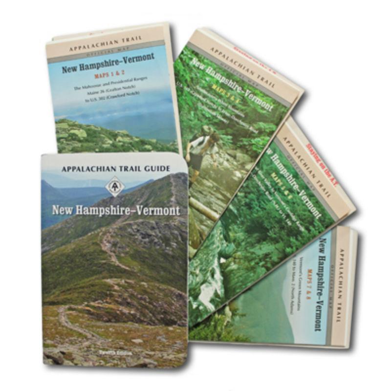
The New Hampshire-Vermont edition covers 329 miles from Grafton Notch, Maine, to North Adams, Massachusetts in one planning guide and eight water- and tear-resistant maps on four sheets. The pocket-sized planning guide contains background information, points of interest, and general advice. The omnidirectional format allows for the inclusion of shelters, water sources, and road crossings. Each map is focused on the Appalachian Trail and overlaps with the neighboring maps. The surrounding area and additional side trails are also included. An easy-to-use elevation profile shows the distance to the next campsite or shelter, side trails, and water sources. For added interest, maps indicate road crossings, waterfalls, and scenic areas. Maps are both water- and tear-resistant.
- Maps 1 & 2:Â The Mahoosuc and Presidential Ranges; Maine 26 (Grafton Notch) to U.S. 302 (Crawford Notch)
Seven-color, 1:63,360-scale topographic maps with 100 feet contour intervals. 1 inch = 1 mile. Revised in 2012.
- Maps 3 & 4:Â Southwestern White Mountains; U.S. 302 (Crawford Notch) to Lyme-Dorchester Road (Dartmouth Skiway)
- Seven-color, 1:63,360-scale topographic maps with 100 feet contour intervals. 1 inch = 1 mile. Revised in 2012.
- Map 5 & 6: Connecticut River Valley to Vermont’s Coolidge Range; Lyme-Dorchester Road (N.H.) to Vt. 140
Seven-color, 1:63,360-scale topographic maps with 100 feet contour intervals. 1 inch = 1 mile. Revised in 2012.
- Map 7 & 8: Vermont’s Green Mountains; Vt. 140 to Mass. 2 (North Adams)
Seven-color, 1:63,360-scale topographic maps with 100 feet contour intervals. 1 inch = 1 mile. Revised in 2012.
No Description Available.
 Oakley
Fuel Cell W/Prizm Polarized
Oakley
Fuel Cell W/Prizm Polarized